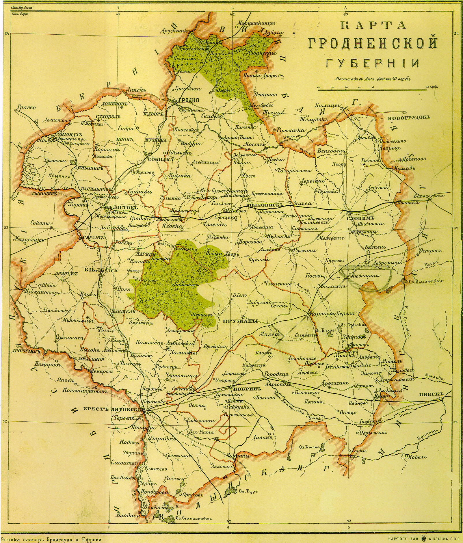
Circa 1900
Approximate Scale: 1 inch
= 7.6 miles, 1 cm = 4.8 kms
In color -- pretty but
takes a while to download
Here are some places that
you might want to locate and how they appear on the map.
What is shown here are
latin letters that resemble the cyrillic letters.
Brest = bPECT"b-AHTOBCKIH
Kobrin = KObPHH'b
Pruzhany = IIPYXAHbI
Bereza = Kapmy3a-bepe3a
Antopol = Anmonori
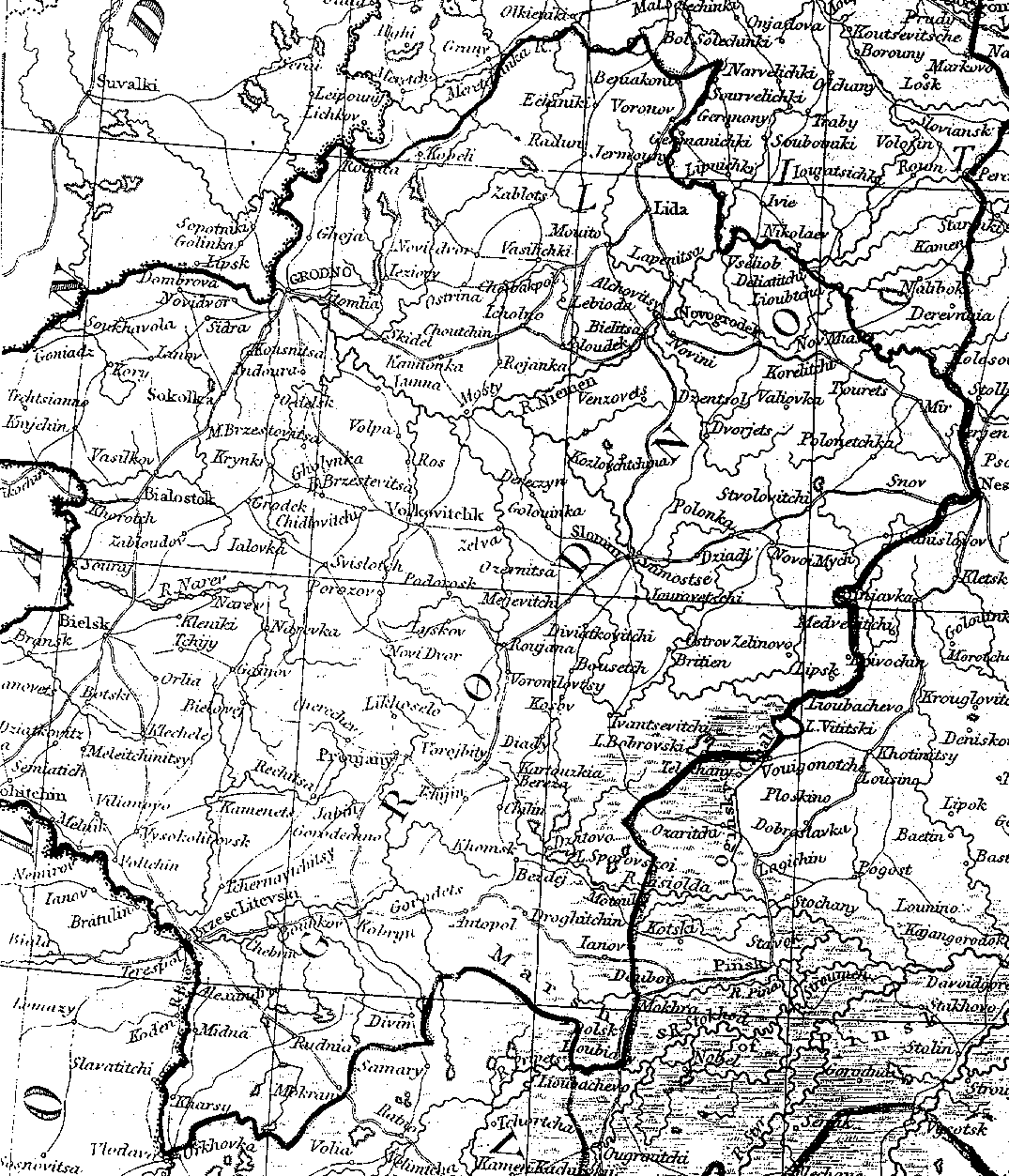
Date unknown but probably
later than the Russian map above
Approximate Scale: 1 inch
= 12.7 miles, 1 cm = 8 kms
In black/white -- not
as pretty but faster to download than Russian map
Here are some places that you might want to locate and how they appear on the map.
Brest = Brzesc-Litevski
Kobrin = Kobryn
Pruzhany = Proujany
Bereza = Kartauzkia Bereza
Antopol = Antopol